The Coledale Round
From
- Start/Finish Braithwaite (NY231236)
- Distance 11 miles (17.5km)
- Time 7 - 8 hours
- Height gain 1500m
- Maps OS Landranger 89 or 90, OS Explorer OL4, British Mountain Maps Lake District (1:40 000)
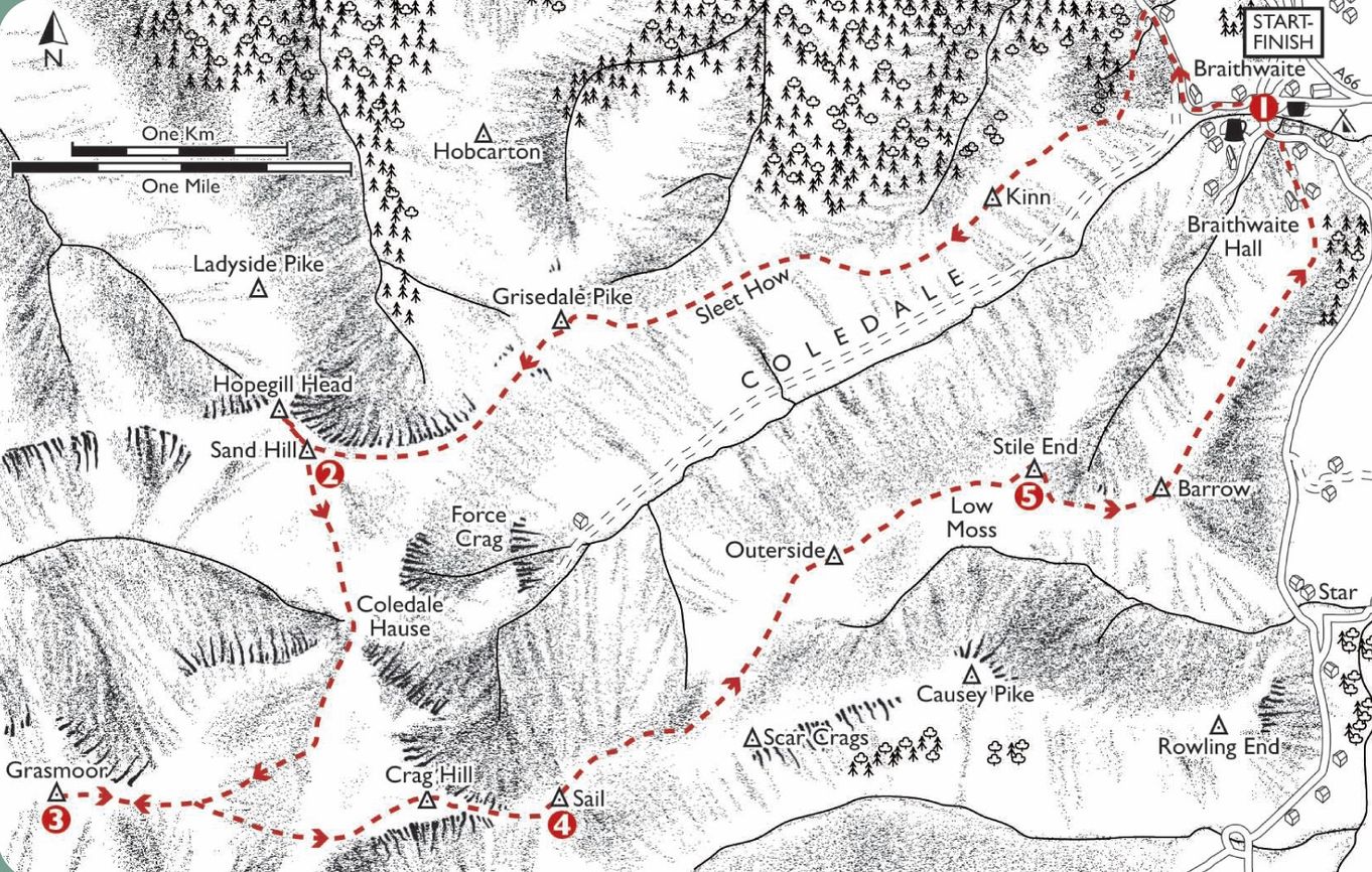
1. Follow the B5292 towards Whinlatter, after 300m follow the path on the left as it climbs then heads west to the first summit, Kinn, establishing you on the main ridge. Follow this to Grisedale Pike then Sand Hill and Hopegill Head.
2. From Sand Hill descend to the deep col of Coledale Hause. From here Crag Hill can be climbed by heading south south east. To visit Grasmoor head instead south south west alongside the beck. Gain the broad higher col between Crag Hill and Grasmoor. A path climbs to the cairn.
3. Return east to the col, continue over it to Crag Hill. The descent to the southern ridge is down a narrow arête with steep slopes – take care. Arrive at a narrow col and continue the climb to Sail.
4. Descend to the next col in an east north east direction. At the junction of paths take the one that skirts the steep fellside to gain the broad col / moss on the south west side of Outerside. Continue north east to the top of Outerside. Cross the summit, descend to a col at Low Moss. Cross this and climb Stile End.
5. Descend to the col at Barrow Door, turn east then east north east for Barrow. A fitting end offering fine views and a high level peek at Keswick and Derwentwater. Descent is simple, drop north east down the main ridge, then follow the path though Braithwaite Lodge to the village.
Have you found this walking route useful and would like to make a donation? All our walks are provided free of charge to download but you might consider donating a small one-off amount to help with the running costs and upgrades to our website. This website is run by Keswick Tourism Association, a not for profit trade organisation, which is funded almost totally by its members.
Download Coledale Round Route
Downloads:


